Washington DC: Complete and Geographically Accurate Track Map The history of the Washington, DC Metro, run by the Washington Metropolitan… Continue reading “Washington DC: Complete and Geographically Accurate Track Map”…
The Devolution of the IND Second System The idea for this post came from an overlooked appendix at the… Continue reading “The Devolution of the IND Second System”…
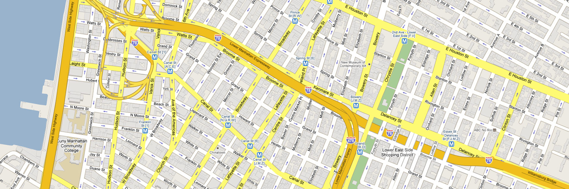
Eastern Promises: Expanding the J, M and L trains The subway lines which serve Williamsburg and Bushwick, the J/Z, M and… Continue reading “Eastern Promises: Expanding the J, M and L trains”…
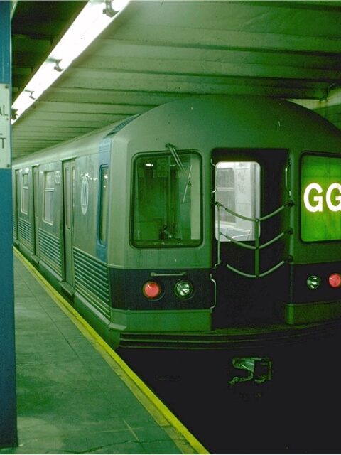
Squaring the Circle: Extending the G Train to Queens The MTA has recently announced that they will be shutting down the… Continue reading “Squaring the Circle: Extending the G Train to Queens”…
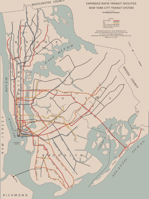
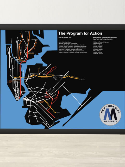
MTA Program for Action 1969 Print A year ago, I did a deep dive into the MTA’s Program… Continue reading “MTA Program for Action 1969 Print”…
Exasperated Infrastructures: The Past, Present, and Future of Transportation Sam Sklar is an urban planner and writer based in NYC. He… Continue reading “Exasperated Infrastructures: The Past, Present, and Future of Transportation”…
Serving Southeast Queens Part 3: Unbuilt Hillside and Van Wyck Lines A look back at the unbuilt IND Van Wyck and Hillside Ave Lines. Continue reading “Serving Southeast Queens Part 3: Unbuilt Hillside and Van Wyck Lines”…
The Last Train to Jamaica: How NYC Almost Replaced Its Els The New York City subway is famously made up of three formerly… Continue reading “The Last Train to Jamaica: How NYC Almost Replaced Its Els”…
Very Expensive Maps Podcast Evan Applegate has probably the best podcast on cartography going. I was… Continue reading “Very Expensive Maps Podcast”…
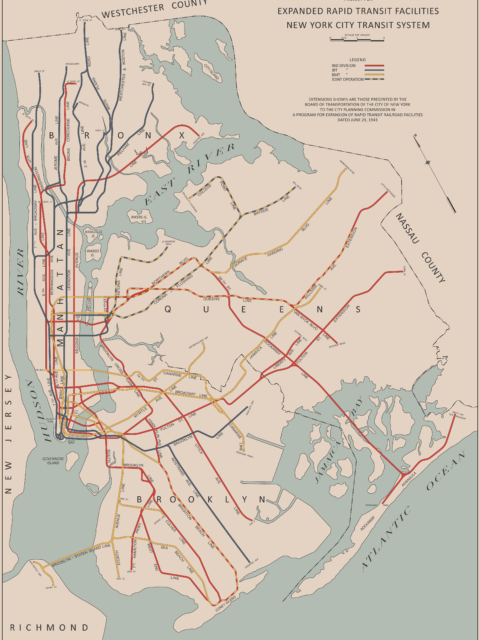
The Lost 1943 IND Second System Plan Students of NYC subway history know this map. It is one of… Continue reading “The Lost 1943 IND Second System Plan”…
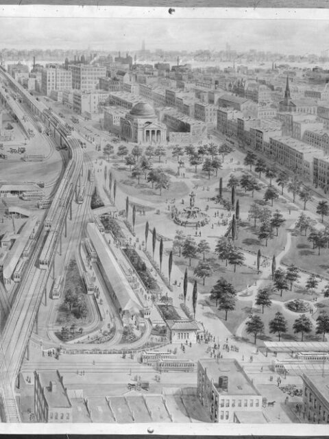
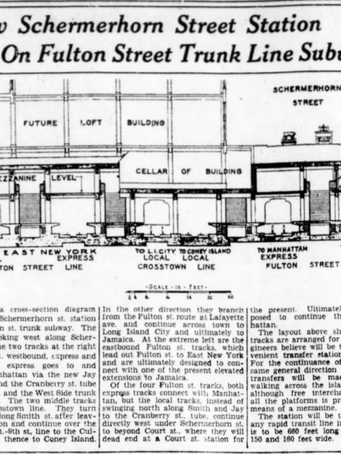
End of the Line: The Unfinished Fulton St Subway When Duke Ellington wrote “Take the A Train” he wasn’t talking about… Continue reading “End of the Line: The Unfinished Fulton St Subway”…
 vanshnookenraggenvanshnookenraggen